


Voting District 21665, Contra Costa County, California
About
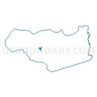
Outline

Summary
| Unique Area Identifier | 529270 |
| Name | Voting District 21665 |
| County | Contra Costa County |
| State | California |
| Area (square miles) | 1.01 |
| Land Area (square miles) | 1.01 |
| Water Area (square miles) | 0.00 |
| % of Land Area | 100.00 |
| % of Water Area | 0.00 |
| Latitude of the Internal Point | 37.91487850 |
| Longtitude of the Internal Point | -122.08009350 |
Maps


Graphs
Select a template below for downloading or customizing gragh for Voting District 21665, Contra Costa County, California


Neighbors
Neighoring Voting District (by Name) Neighboring Voting District on the Map
- Voting District 21170, Contra Costa County, CA
- Voting District 21620, Contra Costa County, CA
- Voting District 21630, Contra Costa County, CA
- Voting District 21650, Contra Costa County, CA
- Voting District 21660, Contra Costa County, CA
- Voting District 21670, Contra Costa County, CA
- Voting District 21675, Contra Costa County, CA
- Voting District 21680, Contra Costa County, CA
- Voting District 21685, Contra Costa County, CA
- Voting District 21700, Contra Costa County, CA
- Voting District 21705, Contra Costa County, CA
- Voting District 21715, Contra Costa County, CA
- Voting District 31890, Contra Costa County, CA
- Voting District 43750, Contra Costa County, CA
- Voting District 43830, Contra Costa County, CA
Top 10 Neighboring County Subdivision (by Population) Neighboring County Subdivision on the Map
Top 10 Neighboring Place (by Population) Neighboring Place on the Map
- Walnut Creek city, CA (64,173)
- Lafayette city, CA (23,893)
- Contra Costa Centre CDP, CA (5,364)
- Saranap CDP, CA (5,202)
- Acalanes Ridge CDP, CA (1,137)
Top 10 Neighboring Elementary School District (by Population) Neighboring Elementary School District on the Map
- Walnut Creek Elementary School District, CA (47,358)
- Lafayette Elementary School District, CA (26,645)
Top 10 Neighboring Secondary School District (by Population) Neighboring Secondary School District on the Map
Top 10 Neighboring Unified School District (by Population) Neighboring Unified School District on the Map
Top 10 Neighboring State Legislative District Lower Chamber (by Population) Neighboring State Legislative District Lower Chamber on the Map
Top 10 Neighboring State Legislative District Upper Chamber (by Population) Neighboring State Legislative District Upper Chamber on the Map
Top 10 Neighboring 111th Congressional District (by Population) Neighboring 111th Congressional District on the Map
Top 10 Neighboring Census Tract (by Population) Neighboring Census Tract on the Map
- Census Tract 3400.02, Contra Costa County, CA (7,000)
- Census Tract 3400.01, Contra Costa County, CA (5,857)
- Census Tract 3390.02, Contra Costa County, CA (5,574)
- Census Tract 3410, Contra Costa County, CA (4,864)
- Census Tract 3240.01, Contra Costa County, CA (4,615)
- Census Tract 3382.03, Contra Costa County, CA (4,564)